Ukraine Receives Initial €3.2 Billion from EU Loan Package
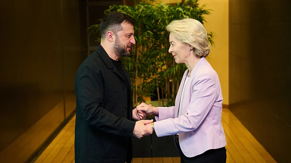
Ukraine gets 3 2 billion – The European Union has begun disbursing its €90 billion support package to Ukraine, with the first installment totaling €3.2 billion, according to EU Commission President Ursula von der Leyen. This move marks a pivotal moment in the bloc’s financial aid efforts, as the funds are intended to stabilize Kyiv’s economy and address critical budgetary shortfalls. The announcement was made during the Ukraine Recovery Conference in Gdańsk, Poland, where von der Leyen addressed Ukrainian Prime Minister Yulia Svyrydenko.
“Today, we are transferring the first tranche under this loan, dear Yulia, it is exactly €3.2 billion in macro-financial assistance,” von der Leyen stated. “This is indeed solidarity in action. It shows Europe’s support for Ukraine is here to stay.”
The €3.2 billion allocation will provide immediate relief to Ukraine’s struggling economy, helping to cover essential expenses and maintain public services. This financial injection comes amid ongoing military operations against Russian forces, which have seen recent gains for Kyiv. The EU’s commitment to funding Ukraine reflects its determination to sustain the country’s resilience during the war.
Political Struggles and Financial Resilience
The agreement to fund the €90 billion loan was reached after months of negotiation among EU member states. Initially, a proposal to tap into Russia’s frozen assets was considered, but it collapsed at the last minute. As a result, the bloc opted for a joint debt mechanism to provide the necessary support. This decision required swift technical and legal coordination to ensure timely disbursements and prevent Kyiv from facing a fiscal crisis.
Despite these efforts, the process faced setbacks when Hungary’s Prime Minister Viktor Orbán suddenly vetoed the loan’s final legislative approval. His action was linked to a separate dispute over the Druzhba oil pipeline, which Ukraine had requested to manage more autonomously. Orbán’s veto triggered heated diplomatic tensions between Budapest and Kyiv, with Brussels mediating the conflict. The stalemate was only resolved in late April following Orbán’s electoral loss in Hungary, which weakened his position within the EU.
The successful disbursement of the first €3.2 billion now signals progress in the EU’s support for Ukraine. However, the financial aid remains conditional on Kyiv implementing key reforms, particularly in addressing corruption. Any regression in these efforts could lead to a temporary suspension of assistance. The Commission has emphasized that the loan’s sustainability hinges on Ukraine’s ability to maintain fiscal discipline and governance improvements.
Strategic Components and Military Aid
While the financial component of the loan has been approved, the military portion carries additional requirements. The EU aims to ensure that funds are used to procure “Made in Europe” weaponry and ammunition, prioritizing domestic industries. Nevertheless, the next €6 billion installment will be exempt from this rule, as Ukraine needs to source specific components from China to produce its cost-effective drones.
Ukraine is also actively seeking to acquire US-made Patriot air defense systems, a critical need for its military strategy. The European loan could potentially support this procurement, but it remains uncertain whether the funds will be allocated for this purpose. A Commission spokesperson highlighted that Kyiv must provide detailed product schedules to guide the allocation of resources. “Ukraine has the opportunity to analyze the battlefield situation and determine the range of products they require, then inform us through structured procurement plans,” the official explained.
Brussels has allocated €45 billion for 2026, with €16.7 billion earmarked for financial aid and €28.3 billion for military support. The remaining €45 billion is reserved for 2027, covering two-thirds of Ukraine’s projected funding needs. Western allies, including the United States, are expected to contribute the remaining third, though the U.S. has yet to commit to this portion. Von der Leyen reiterated the importance of maintaining this collaborative effort: “Our ambition is not only to help Ukraine endure, it is also to help Ukraine grow and prosper as a free and European country.”
Long-Term Implications and Repayment Conditions
The EU’s financial aid will be funded by its 24 member states, which will collectively bear an estimated €3 billion in annual interest costs. Ukraine will only be obligated to repay the €90 billion loan if Russia agrees to compensate for war damages, a condition Moscow has explicitly rejected. This clause provides Kyiv with financial security, as the EU retains the authority to utilize Russia’s immobilized assets from the Central Bank, totaling €210 billion, in the absence of reparations.
Von der Leyen underscored the EU’s long-term vision for Ukraine, stating that the loan is not just a stopgap measure but a strategic investment in the country’s future. “A strong and independent Ukraine is in all our interests,” she said. The disbursement of funds will be gradual, with payments scheduled throughout the year to ensure Ukraine can manage its financial obligations sustainably.
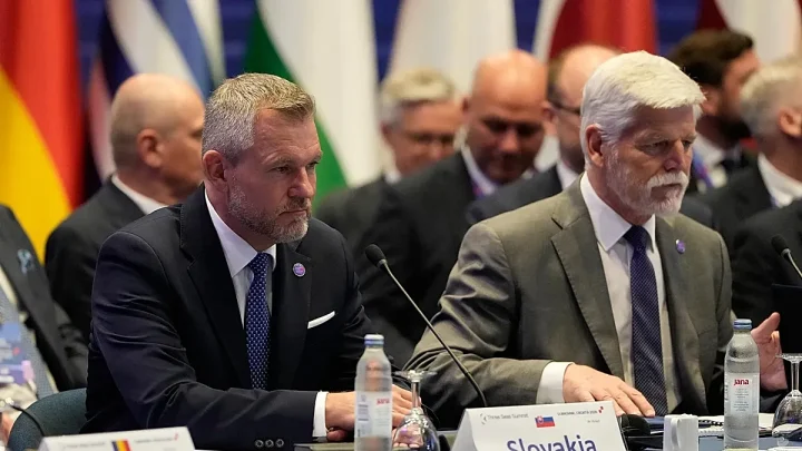
As the EU continues its support, challenges persist. The political landscape remains complex, with some member states pushing for exemptions from the joint debt scheme. Hungary, Slovakia, and the Czech Republic had negotiated temporary exclusions from the program, highlighting the need for compromise among the bloc’s leaders. These dynamics underscore the EU’s balancing act between unity and individual national priorities.
The ongoing conflict in Ukraine has reshaped the continent’s economic and political strategies. With the war entering its fourth year, the EU’s financial commitment serves as a cornerstone of its collective response. The initial €3.2 billion disbursement represents a symbolic victory for the bloc’s cohesion, but the road ahead demands vigilance and adaptability. As Kyiv navigates its recovery, the EU’s ability to deliver on its promises will determine the success of its long-term partnership with Ukraine.